On this page
Introduction to map.army — military map planning
This first-steps guide introduces map.army, the browser-based progressive web app for planning military exercises and missions, and walks you through launching it and getting around the main window. About five minutes; no installation required.
Launch the app
To start map.army, open www.map.army in a supported browser — other browsers won’t support every feature. map.army is a progressive web app, so you can install it on your device and run it like a native app — follow the install instructions for your browser and OS.
Two cases map.army refuses or warns about at start-up, both of them outside its control:
- Opening a link from inside Facebook. Facebook’s built-in browser cannot run the app, so map.army stops and asks you to open the address in a real browser instead. Copy the link, or use your browser’s Open in… option.
- Downloading on some Xiaomi devices. Their built-in download manager can corrupt a saved file, so map.army warns you before a download. Save through a different browser if you see it.
Main window
By default, map.army opens in the main window. Installed as a progressive web app it runs in its own window, without browser tabs or an address bar:
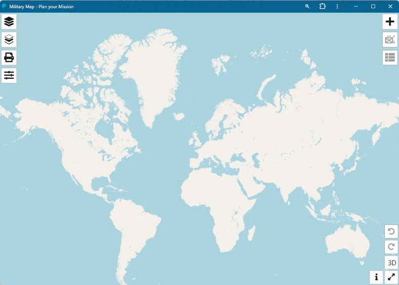
The map fills the window, and the controls sit around its edges: four buttons down the left, three down the right, and five in the bottom-right corner. Nothing is hidden in a menu bar — every function in the next section is one click away.
Functions in the main window
Twelve controls frame the map. Each name below is the button’s own tooltip — hover a button in the app and you will read exactly this.
| Icon | Position | Function | Description |
|---|---|---|---|
 | Left, 1st | Layers | Opens the Layers menu, where Military Map overlays are created, loaded, activated and saved. An overlay can be a MilX Layer, a vector layer or an image overlay. |
 | Left, 2nd | Active/Selected Layer | Shows the symbols on the layer you are currently working in, so you can pick one out without hunting for it on the map. |
 | Left, 3rd | Print map or Export to PDF | Prints the map, or exports the section you choose as a PDF. |
 | Left, 4th | Options | Opens the settings panel — map appearance, coordinate formats, symbol format and the app-wide options. |
 | Right, 1st | Add new MSS Symbol | Finds a military symbol through the Symbol Gallery or the advanced symbol search, and places it on the active layer. |
 | Right, 2nd | MSS Symbol Editor | Adds modifiers and attributes — echelon, affiliation, status and the rest — to the symbol you have selected. |
 | Right, 3rd | View and edit graphic’s coordinates | Lists the reference coordinates of the selected symbol or tactical graphic, and lets you type them in directly. |
 | Bottom right | Undo (Ctrl + Z) | Reverses your last change. |
 | Bottom right | Redo (Ctrl + Y) | Re-applies a change you have just undone. |
 | Bottom right | 3D | Switches to the 3D map view, which is read-only — you can look around it but not draw in it. The button then reads 2D and takes you back to the editable 2D map. Not available on iOS. |
 | Bottom right | Message & Info Center | Shows service messages and links to further information about the app. |
 | Bottom right | Full screen [F11] | Runs map.army full screen, without the window frame. |
You need an active layer before you can work with symbols at all. Adding, editing, moving and deleting a military symbol — every one of them acts on the active layer, so with no layer active the app has nowhere to put the change and the controls stop responding. This is the single most common thing new users run into.
- Add new MSS Symbol is disabled until a layer is active. A new session opens with one empty layer already active, so it normally works straight away — but it greys out the moment no editable layer is active, for instance when you select a read-only layer or remove the active one.
- MSS Symbol Editor and View and edit graphic’s coordinates need an active layer and a selected symbol, since both act on one specific graphic.
These buttons are shown but disabled rather than hidden, so hovering still reveals the tooltip while clicking does nothing. If the active layer is deselected while the symbol panel is open, the panel closes itself.
The fix is always the same: click a layer’s name in the Layers panel to activate it. The layer list marks the active layer with a pencil; a checkmark instead means that layer is read-only and nothing will draw on it. See MilX Layers.
Run the app in full-screen mode
Click the Full screen [F11] button in the bottom-right corner to run map.army full screen. The window frame gives way to the map, which is what you want while drawing:
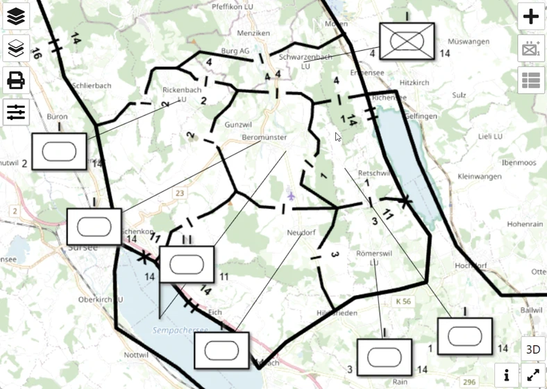
Full-screen mode works in both 2D and 3D map view. Click the button again to leave it.
[F11] in that button’s name. F11 is your browser’s full-screen key, not something map.army binds — the button label mentions it as a convenience. So it works wherever your browser makes F11 full screen (Windows and Linux, typically) and does nothing where it does not, such as on macOS. The button itself always works.